🔗 NEW CASE STUDY: Using ROVs for Submerged Nuclear Asset Inspections at Dominion Energy
- 首页ShopROV | Sonar & PositioningBlueprint SeaTrac USBL Positioning System | Deep Trekker
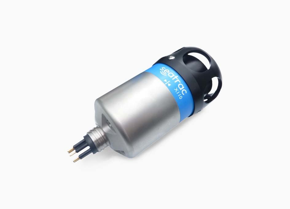
Blueprint SeaTrac USBL Positioning System | Deep Trekker
The SeaTrac Ultra Short Baseline Locating system enables positional awareness of your ROV, set waypoints, and program autonomous routes. When piloting an ROV in open water missions, understanding where you are or where you have been can be challenging. Without the ability to utilized GPS underwater, ROVs rely on the use of this sound technology for navigation and locating.
添加商品到报价时出错
已添加到报价

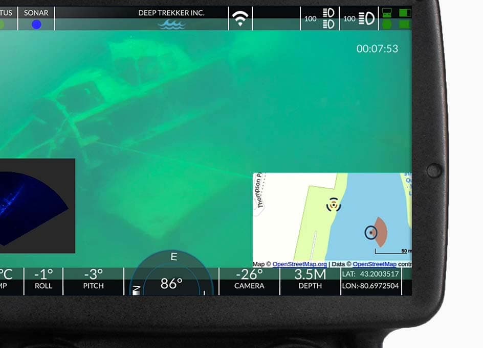
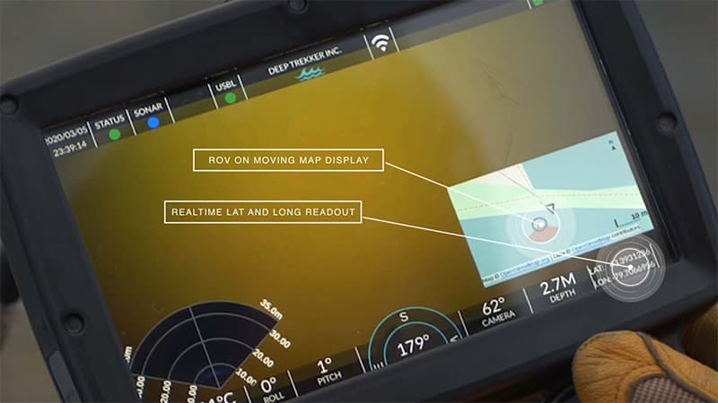
Track ROV position underwater

On-screen integration

1 km range
Bridge integrated Blueprint Subsea SeaTrac Ultra Short Base Line (USBL) Positioning System for tracking ROVs
Using a dunking transducer at the surface and a transponder mounted to the top of the ROV, the two communicate using acoustics. The relative position of the ROV to the dunking transducer is calculated and then through Bridge software is displayed on a Google Map on your controller. Allowing you to visualize your position during your dive, plot points of interest.
In open water applications where you want to know exactly where you are and where you are going, you use this positioning system to track your ROV. Our Ocean Science customers use this to track where they saw certain features and log data over the span of their dive. Inspection companies inspecting critical infrastructure use the USBL to log where they find defects and anomalies during an inspection.
In open water applications where you want to know exactly where you are and where you are going, you use this positioning system to track your ROV. Our Ocean Science customers use this to track where they saw certain features and log data over the span of their dive. Inspection companies inspecting critical infrastructure use the USBL to log where they find defects and anomalies during an inspection.
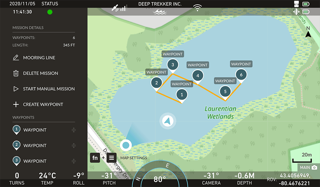
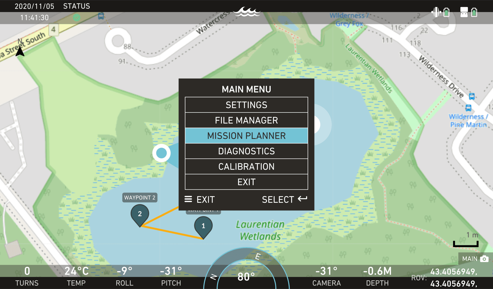
Mission planning
With Deep Trekker's Mission Planner you can create waypoints at pre-defined locations or import a spreadsheet and have these coordinates or geo locations displayed on the map at all times.
Mission planning can also help you keep track of locations you want to return to. Simply create a waypoint or drop one using the program button while piloting to get added to the mission file.
Compatible with

我们使用 Cookie 收集有关您与我们网站交互的信息,以改善和个性化您的体验。请参阅我们的 隐私政策 了解有关 Cookie 使用的更多信息。