Configure Now
Items in Your Cart0
0Items in Your Cart
Start building your packageShop Now
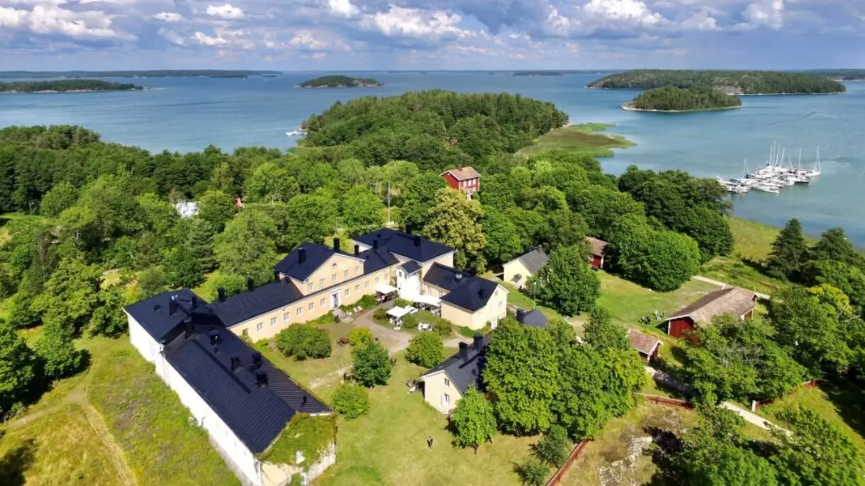
The Archipelago Research Institute (ARI), a marine field station at the University of Turku, runs one of the longest-running Baltic herring research programs in Northern Europe — a continuous record of reproductive biology and spawning-habitat conditions stretching back more than 40 years along the Finnish coastline.
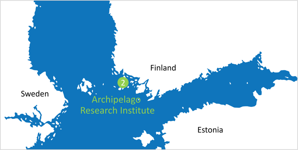
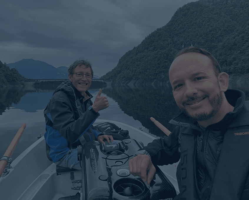
"Since the early 1980s, we have collected long-term data on spawning herring populations, especially in the northern Baltic Archipelago Sea near the city of Turku, Finland," explains Senior Researcher and Baltic Herring project lead Katja Mäkinen. “We have two field stations, one in the archipelago and one in Lapland in northern Finland. Our archipelago station is located amidst this Baltic herring spawning area.”
For decades, the underwater half of that work depended on divers — an approach that grew harder to justify as costs, safety requirements, and logistics mounted, and as declining commercial fisheries left the team sourcing its own biological samples. The shallow, wave-exposed spawning grounds near Turku, where eutrophication and river runoff routinely cut visibility, only added to the difficulty.
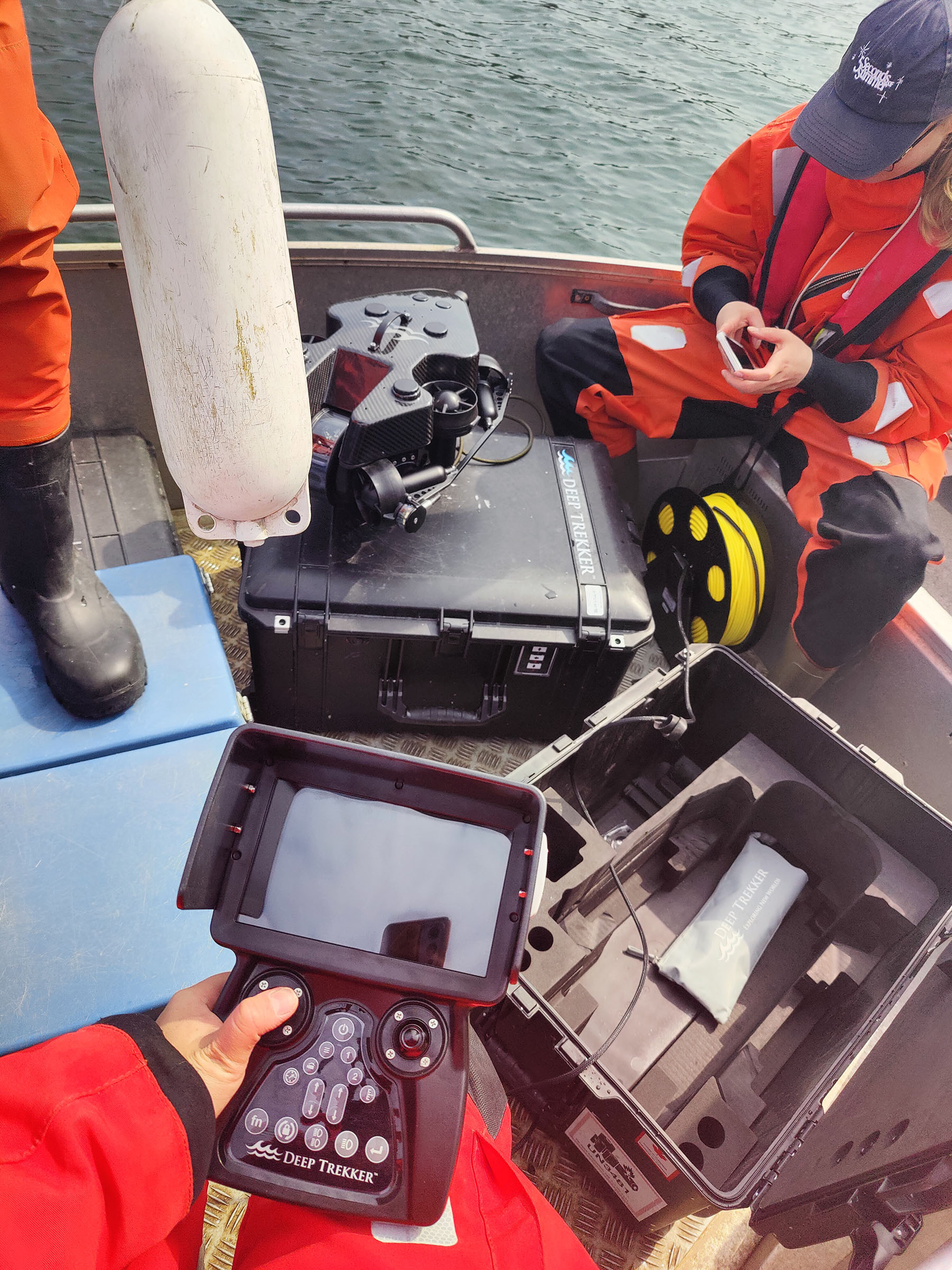
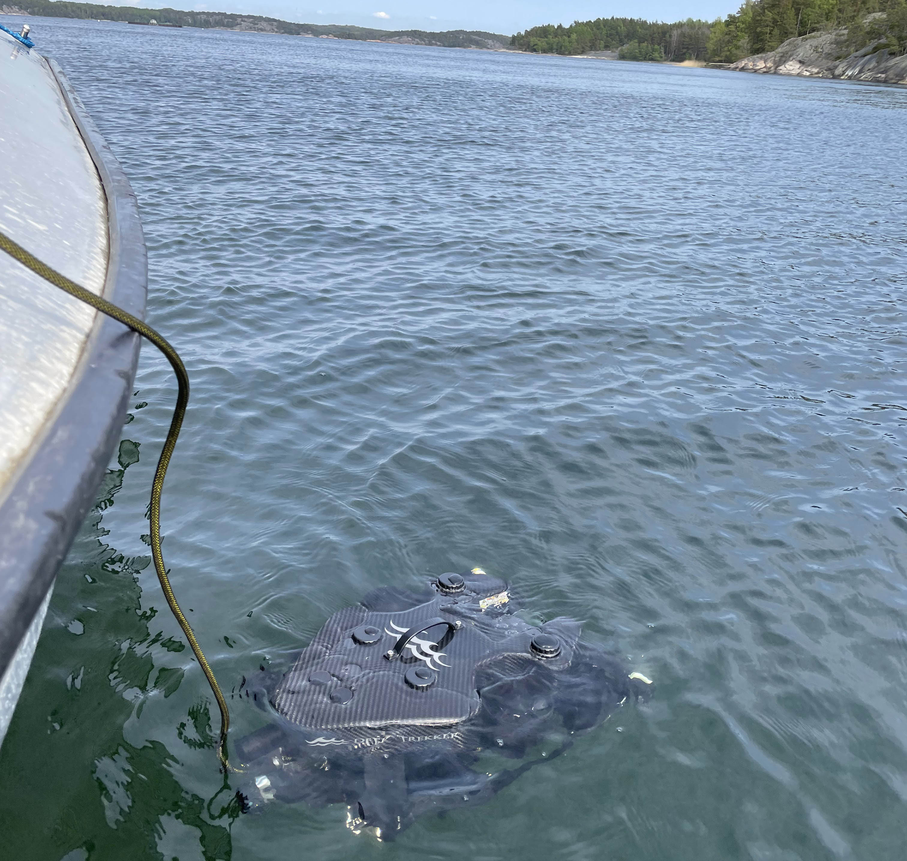
Today, ARI conducts those same spawning-ground assessments, habitat surveys, and behavioral observations with Deep Trekker PIVOT and PHOTON ROVs, deployed from the small boats the team already runs twice a week throughout the spawning season. The result is a lower-cost survey method folded directly into existing fieldwork — one that has restored underwater monitoring the institute could no longer afford to run with divers, while expanding who can collect data and creating a permanent video archive alongside a 40-year biological record.
As Mäkinen puts it simply: "It's just a cost-effective way to get more data."
This case study examines how ROV-based observation lowered survey costs, increased access to spawning habitats, and strengthened continuity across a multi-decade research program.
By replacing dedicated diver campaigns with ROVs deployed on existing field trips, the University of Turku expanded its underwater monitoring while reducing survey costs. In the current spawning season alone, the team ran seven dedicated ROV survey trips on top of its twice-weekly trap-net checks — added underwater data collection that wouldn't have been feasible under a diver-based model.
The University of Turku adopted ROV technology to restore underwater survey capabilities that had become difficult to justify through conventional diving programs.
During the early years of the Baltic Herring Project, researchers conducted diver-based surveys. Over time, those surveys became increasingly difficult to maintain due to cost, logistics, and safety considerations.
“It's quite expensive to employ divers, and there are, of course, safety issues to consider as well,” explains Mäkinen.
The challenge became particularly important as commercial fisheries in the region declined. Researchers could no longer rely on commercial catches for biological samples and began deploying their own research trap nets during spawning season. Because these nets are positioned directly on spawning grounds, researchers saw an opportunity to combine routine monitoring trips with underwater inspections using an ROV. Rather than securing additional funding for specialized dive operations, the team could integrate underwater surveys into existing field activities. This operational flexibility has generated a measurable return on investment by allowing researchers to collect more data using existing personnel, vessels, and field schedules.
“I like that you get video footage as well,” says Mäkinen. “The recordings can be stored and revisited later as research advances. With diving, you typically receive a report and rely on the diver's observations, but with the ROV, the footage can be shared and reviewed by others.”
Discover how Natural England uses ROVs to improve marine habitat monitoring, reduce costs, and improve marine protected area surveys across the UK coastline.
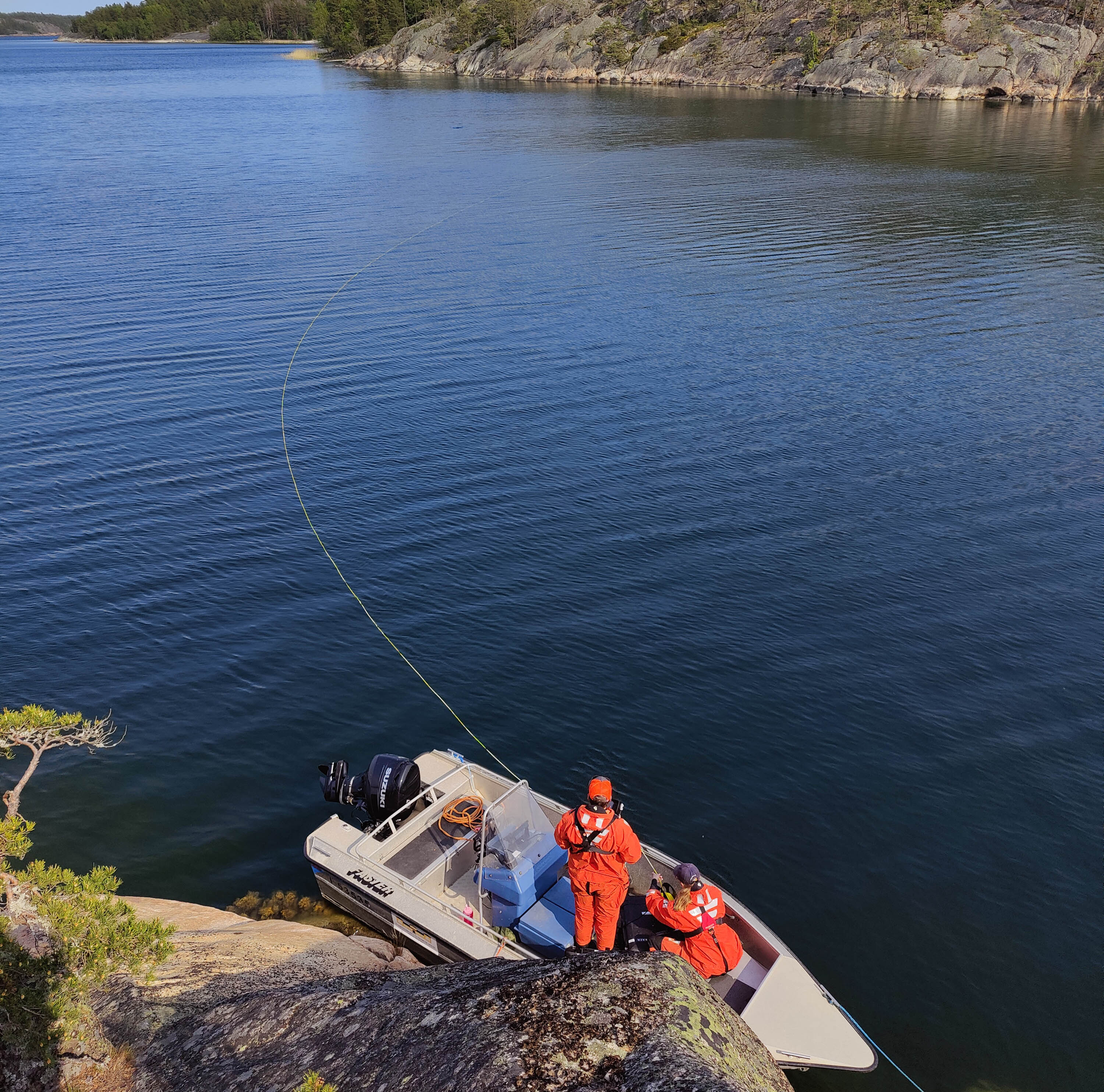
ROVs reduce research costs by eliminating many of the expenses associated with diver deployment while increasing the amount of data collected during each field trip. The Baltic Herring Project conducts trap net inspections twice per week throughout the spawning season. Researchers already travel to spawning sites regularly using small motorboats.
“We haven’t conducted diving surveys for many years, but these ROVs allow us to carry out surveys again in a more cost-effective way,” notes Mäkinen.
Rather than requiring separate dive campaigns, the research team embeds underwater data collection by deploying the ROVs during existing field visits aligned with trap net checks throughout the spawning season from April to July. As Mäkinen explains, “We check the trap nets two times a week when they're deployed in the sea,” and “We typically take the equipment with us when we go to the trap nets to check them.”
By bringing along the ROV on established sampling trips, the team is able to conduct underwater observations as part of its regular workflow. This approach increases opportunities for underwater observation without adding separate field logistics or dedicated survey expeditions.
“Compared to diving, the ROV has made spawning ground monitoring much easier,” says Mäkinen. “We no longer need to secure larger project grants to carry out this work and can instead incorporate it into our day-to-day activities. Students are able to use the equipment, as well.”
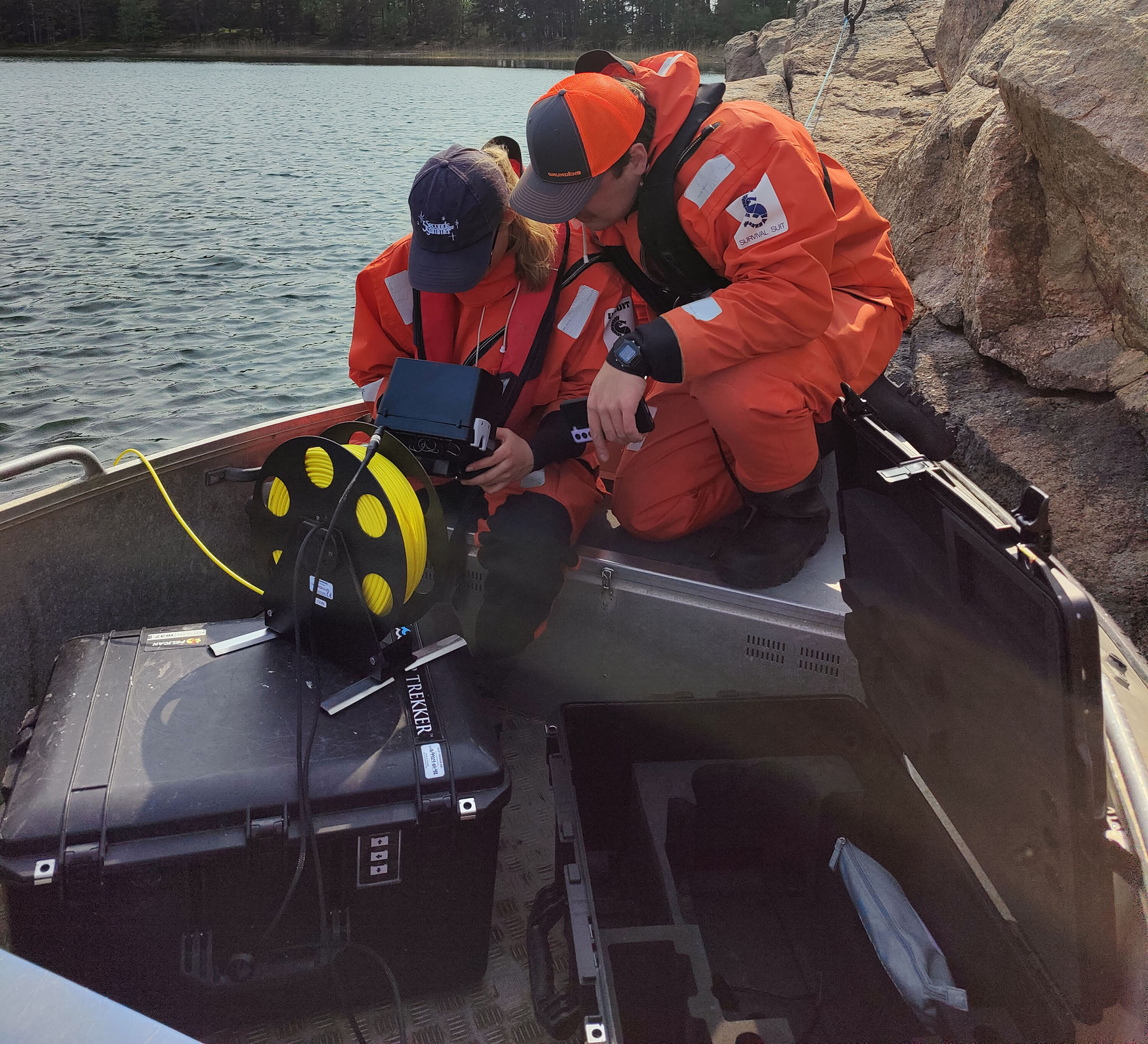
Adding an ROV requires little additional preparation. Instead of scheduling dive teams, arranging safety protocols, or contracting external survey services, the team simply transports the equipment alongside existing monitoring gear. The financial benefit extends beyond labor savings.
ROV operations also allow students and researchers without dive certifications to participate in underwater surveys, expanding access to underwater data collection across the institute. As Mäkinen noted, “Not all want to go diving or are able to do that”. By making underwater observations accessible to a broader group of researchers and students, the institute can collect more data while avoiding the recurring costs and logistical requirements associated with diver-based surveys.
For decades the question facing the Baltic Herring Project wasn't whether to monitor spawning grounds, but whether it could keep affording to. Diver-based surveys delivered the underwater view researchers needed, but the cost, safety requirements, and logistics made them increasingly hard to sustain — until ROVs let the team resume that work on a fraction of the operational footprint.
The contrast below reflects ARI's own experience moving from diver surveys to Deep Trekker PIVOT and PHOTON ROVs:
| Diver-based surveys | Deep Trekker ROV surveys | |
|---|---|---|
| Cost model | Recurring diver contracting fees; often required dedicated project grants to run | Runs on day-to-day budget; no separate grants needed |
| Field logistics | Scheduled as separate dive campaigns | Folded into existing twice-weekly trap-net trips (April–July) |
| Safety | Dive safety protocols and risk to personnel | No in-water personnel; no diving risk |
| Who can collect data | Certified divers only | Students and researchers without certification |
| Data output | Written report; relies on the diver's observations | Reusable video footage that can be shared and reviewed |
| Repeat access | Limited by cost and scheduling | High — equipment travels on routine sampling trips |
| Cost per survey | High | Near-zero marginal cost on an already-scheduled trip |
The decisive difference is where the cost sits. A diver survey is a standalone expense the team had to fund and schedule on its own; an ROV survey is a near-free add-on to a trip the team is already making. As Mäkinen puts it: "We haven't conducted diving surveys for many years, but these ROVs allow us to carry out surveys again in a more cost-effective way."
The footage column matters as much as the cost column. A diver survey ends with a report; an ROV survey ends with a permanent visual record the team can revisit years later, cross-check against biological samples, and share with other researchers, artists, and decision makers — a one-time spend that keeps returning value.
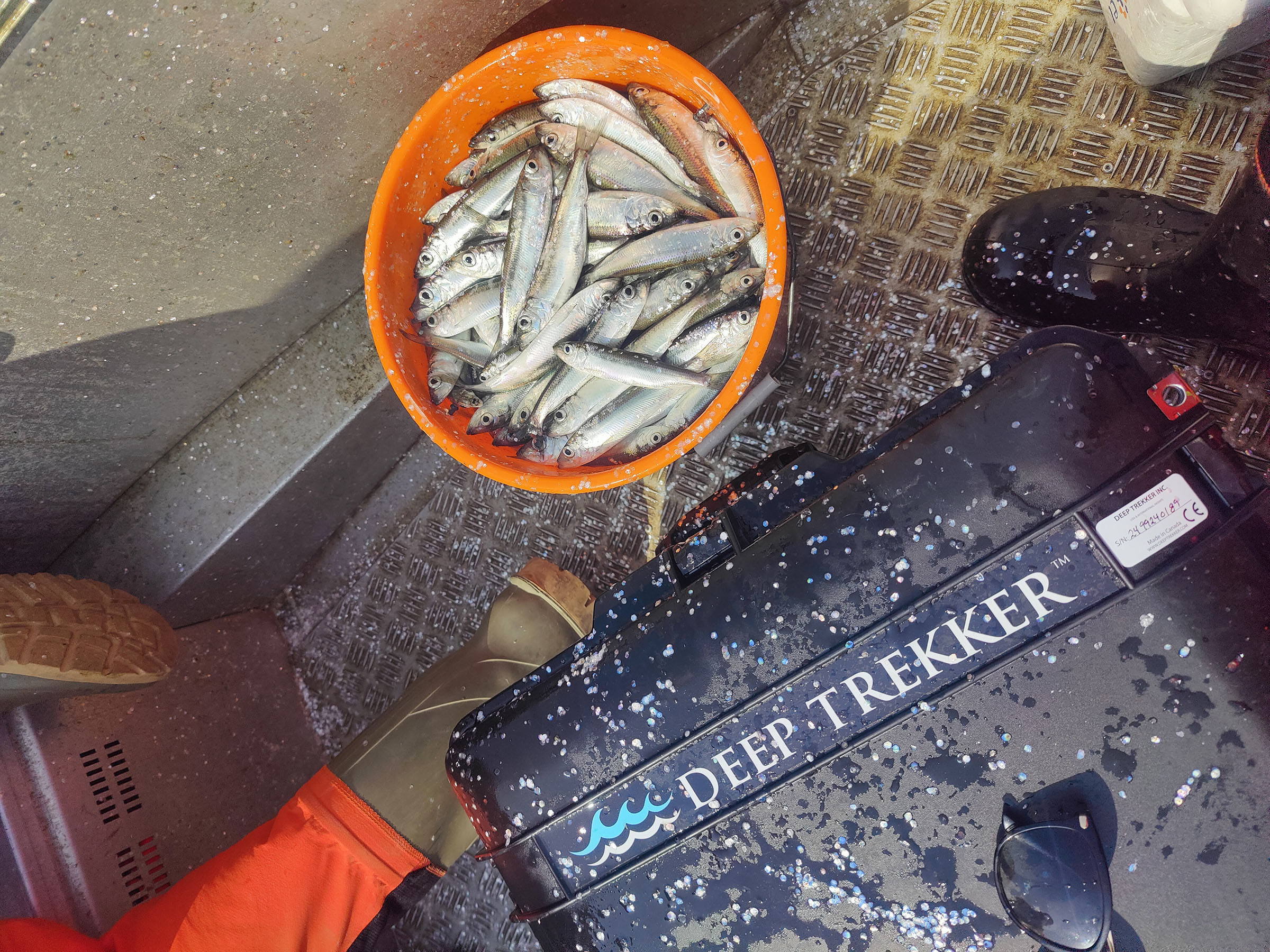
Yes, ROVs can reliably identify species and assess habitat conditions even in low-visibility coastal water. According to Mäkinen, ROV imaging has been effective for identifying species and assessing habitat conditions in shallow coastal environments affected by variable water clarity, “The visibility is low due to eutrophication and river inflow,” she explains. These conditions fluctuate year to year and even within a single field season.
Despite these challenges, researchers reported strong performance from the submersible drone’s imaging system. “We were really happily surprised by the image quality,” she noted. “We're able to identify species from the video footage…It's quite easy to identify the bottom plants and algae.” Field deployments have also captured direct observations of spawning behavior during the May 2024 field season.
“Two years ago we were able to film a herring school and observe spawning behaviour, which was quite exciting,” says Mäkinen. “It’s really valuable that we can adjust our schedule in real time when something interesting appears…With the herring school, we stayed for several hours—longer than planned—to observe and monitor their behaviour, since there isn’t much information available on it. Seeing that in real time was quite exciting.”
Video isn't just a record-keeping convenience; it's where an ROV survey quietly out-earns a diver survey over time. A diver campaign produces a written report: a one-time deliverable, paid for once, limited to what the diver remembered and noted. An ROV survey produces footage that the team owns permanently and can draw on again and again. Each trip's cost is incurred once; the value keeps returning. That's a compounding return on every survey — the kind of asset that appreciates against a multi-decade dataset rather than depreciating into a filing cabinet.
Traditional dive surveys rely on the diver's knowledge of what they're observing, captured in field notes after the fact. ROV footage, by contrast, is direct visual evidence that can be revisited years later as new research questions arise.
The Baltic Herring Project also maintains biological archives dating back to the 1980s, including tissue and otolith samples. Video data adds spatial and behavioral context to this long-term record.
“It's really nice that we have the footage. We can store it and go back to it later on.” This enables retrospective analysis when new research questions arise and supports long-term environmental comparisons. The recordings can be shared and reviewed by others, rather than living with a single observer.
That reusability is what turns a single field trip into a long-term asset. The same footage does multiple jobs across the institute, each one a separate return on the same one-time cost:
"It's quite eye-opening to see the current state of the spawning fronts and to use that information to communicate it to decision makers," Mäkinen notes. The footage is also used beyond research contexts, including outreach and education. “We do quite a lot of research and outreach,” Mäkinen noted. “It's really nice to provide the footage to artists and then to the general public as well.”
Set against a diver's one-time report, every hour of footage is an asset that keeps paying out — across research, validation, outreach, and policy — long after the survey trip that produced it.
Station keeping is a critical feature used to support observation stability during spawning surveys in shallow, wave-affected environments.
“Holding the ROV in place has been really key for surveying,” says Mäkinen. “There is a lot of loose sediment, so staying in place has been very important. When we filmed the herring school as well, we found it was best to stay in one position and simply film as the school moved around us.”
During behavioral observation of herring schools, the ROV was held stationary to avoid disturbing natural movement patterns. “Staying in place has been really good.” This approach supports more consistent visual datasets by reducing motion variability and minimizing environmental disturbance during observation periods.
Researchers found stationary positioning useful for maintaining consistent observation of fish behavior while minimizing disturbance during filming.
“There are a lot of waves and big vessels going by in the areas where we operate,” says Mäkinen. “We’ve found the station keeping functionality really useful. We also work at shallow rocky bottoms where waves are common due to the shallow depths. When we station the ROV in one place, it has managed quite well with the wave conditions.”
Ease of use has supported adoption across students, visiting researchers, and field staff at the station. Mäkinen notes, “We got really good instructions,” and adds that “We used your videos and instruction websites quite a lot.” The system is actively used by students involved in fieldwork and research activities, with Mäkinen joking, “The students are more capable of using the ROVs at the moment than what I am.” This has enabled broader participation in underwater data collection without requiring dive certification.
“As researchers, we have quite limited time to get acquainted with new equipment, which can be a challenge when introducing new purchases,” says Mäkinen. “We don’t have enough technicians to learn every system in detail, so the faster and easier the process is, the better. That also increases how much the equipment gets used, and allows us to teach other groups and users who come to the station. It’s important to have technology that is fairly intuitive and quick to use.”
Learn how Parks Canada Uses ROVs to investigate historical wrecks and underwater sites while reducing diver risk and improving survey efficiency and accuracy.
ROVs are increasingly being integrated into multiple research and teaching activities at the Archipelago Research Institute.
Ongoing and emerging work includes:
Mäkinen notes that usage is expected to become highly frequent, stating, “We're going to use the ROVs quite intensely, weekly, if not even daily.” The systems are also shared across users at the station, with Mäkinen adding, “It's available for any users that come to the station.”
New work is also being planned around transect surveying and habitat mapping. Mäkinen explains, “Transect service and habitat mapping is something that we're going to actually do this spring and summer. We have a new project where we're doing more intense surveying within our research area, so that's something that we're just planning right now.”
The value of ROV use in this case is operational and scientific, based on expanded observational capacity within existing workflows.
Supported outcomes include:
The system supports ongoing fieldwork by enabling underwater observation within established sampling routines, rather than requiring separate dedicated dive operations.
For ARI, the value of the investment continues to grow as more projects adopt the technology. By reducing dependence on divers, increasing data collection opportunities, supporting education, and creating permanent visual records of underwater environments, the ROVs have become a central component of the institute's research capabilities.
As Mäkinen reflects on the team's experience, "We’ve been really, really happy with it."
Connect With Us to Support Your Next Field Mission
Like the team at the Archipelago Research Institute, research groups worldwide are folding ROV surveys into existing fieldwork to collect more underwater data at a lower cost. Deep Trekker ROVs support safer, more efficient operations across marine research, environmental monitoring, aquaculture, and salvage work, with systems adaptable to both freshwater and ocean environments. Our team works directly with you to configure a solution for your specific application, backed by support that keeps it running reliably in the field.

When you're ready to bring ROV-based observation into your own research, contact us for a personalized consultation and a quote tailored to your requirements.