Configure Now
Items in Your Cart0
0Items in Your Cart
Start building your packageShop Now
As one of the most remote, extreme environments on Earth, Antarctica presents some of the greatest challenges to marine research, demanding innovative and accessible technologies to study ecosystems that remain largely unexplored. Earlier this year, a 24-day expedition brought together a team of 22 women explorers from more than nine countries to retrace Sir Ernest Shackleton's historic Imperial Trans-Antarctic route while conducting interdisciplinary scientific research across the Southern Ocean. The expedition sought not only to follow in the footsteps of historic exploration, but also to reimagine who gets to participate in shaping that legacy today.

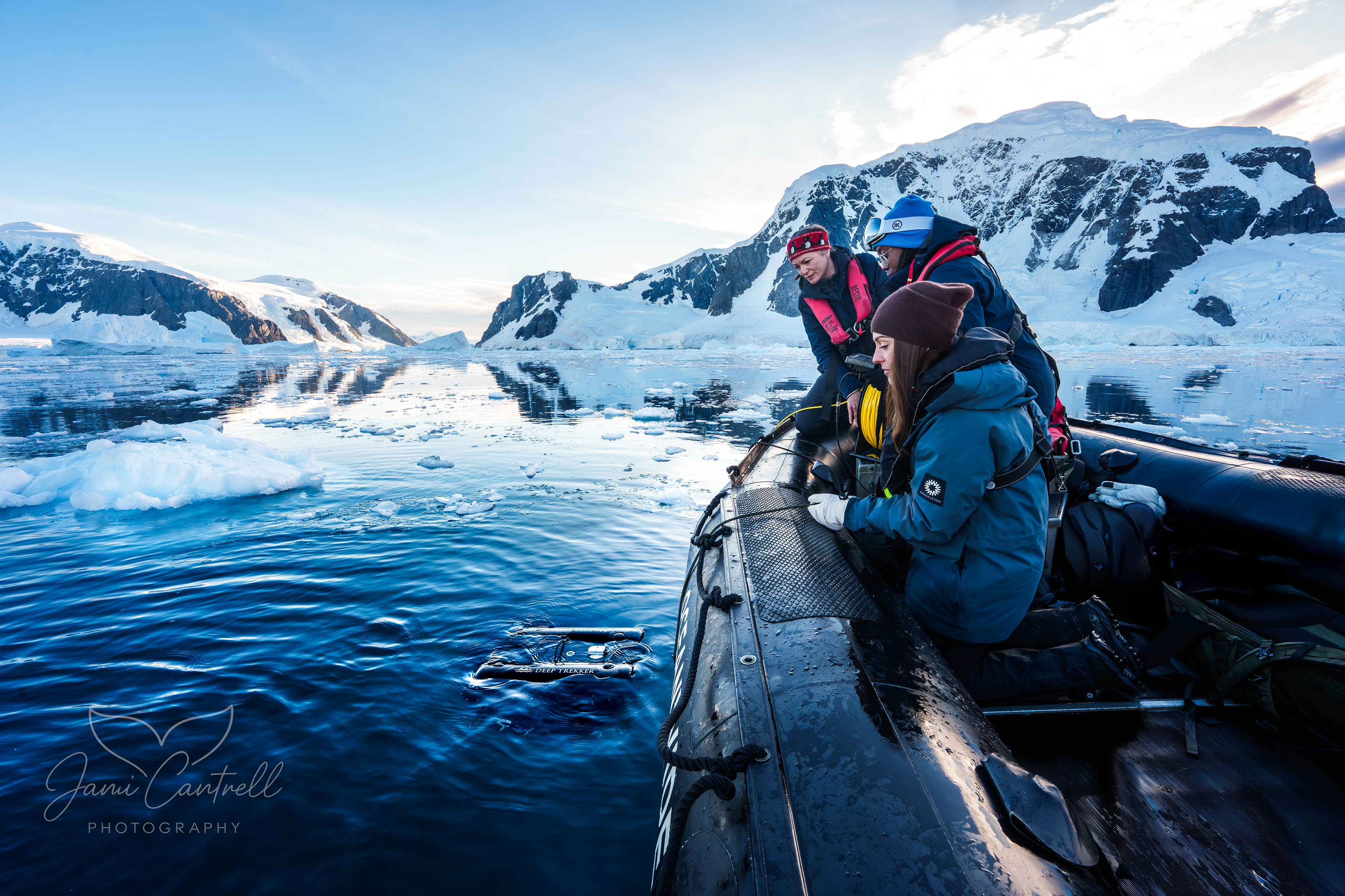
A dedicated four-member Submersible Science Team deployed the Deep Trekker PIVOT ROV system to conduct subsea research in one of the planet's most challenging marine environments. The mission focused on benthic habitat surveys, hydrothermal vent reconnaissance, visual documentation supporting leopard seal ethogram studies, GIS-based comparisons of current and historical glacier extents, under-ice environment observations, and submerged maritime heritage sites including bone deposits that preserve evidence of the region's whaling-era history. Many of these sites had never previously been documented using video. The expedition integrated underwater robotics with interdisciplinary field science to collect 4K resolution datasets that support ongoing research into climate-driven environmental change, polar marine ecosystems, and Southern Ocean processes.
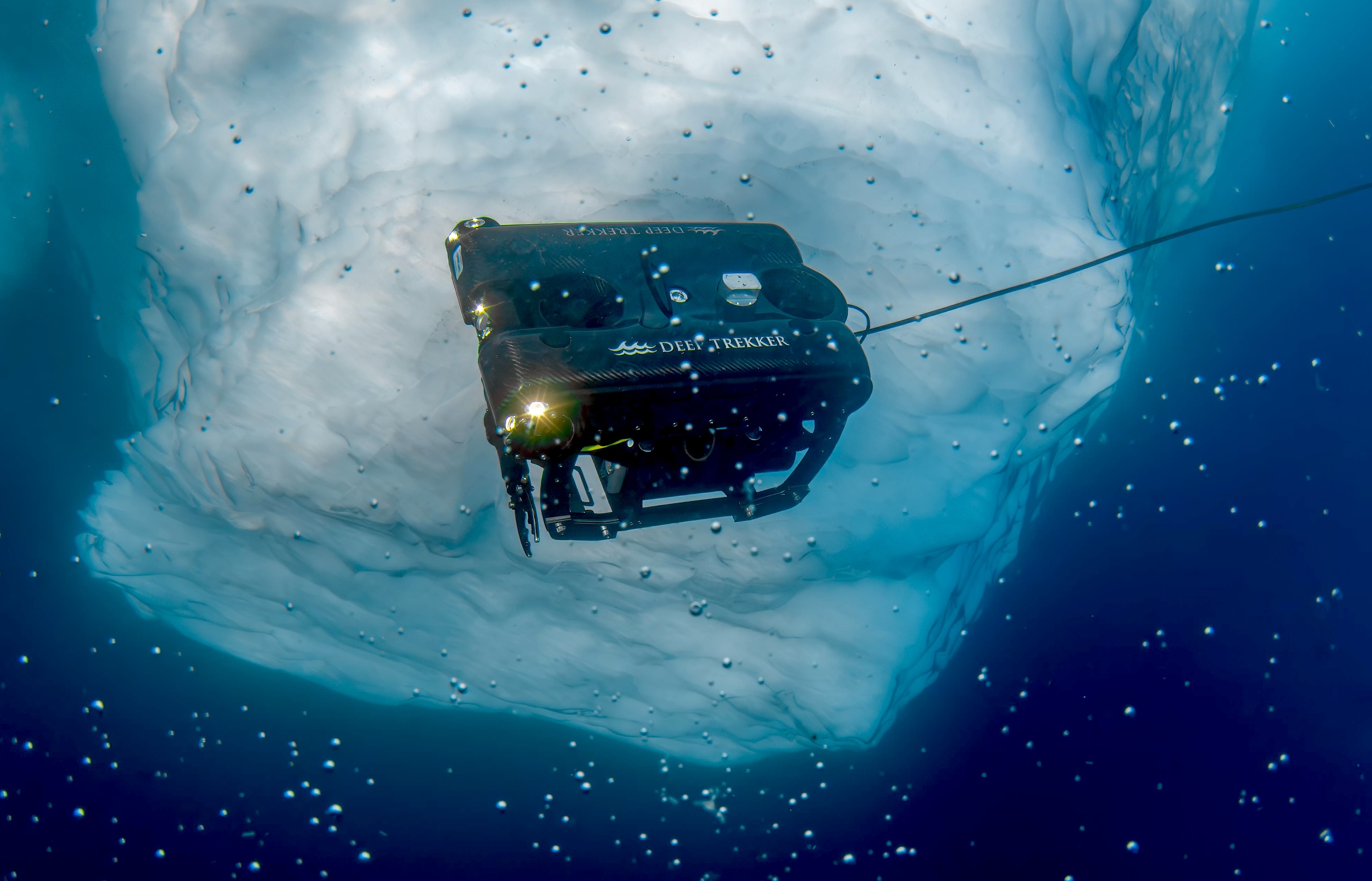
This case study documents the operational deployment of ROV technology within Antarctic field constraints and its role in enabling integrated subsea data collection across science, mapping, and ecological research workflows.
The Deep Trekker PIVOT ROV used for the he Antarctic ROV program contributed to documentation and detailed scientific observations of seabed geology, benthic habitats, water column analysis, anthropogenic impacts, and ice-ocean interactions, while also demonstrating the effectiveness of low-impact, tethered ROV surveys in remote polar environments.
This included capturing hours of 4K video footage from both the seafloor and the overlying water-column that provide valuable baseline information to support ongoing analysis of marine ecosystems. The data collected will contribute to advancing understanding of polar marine processes in a rapidly changing environment.

The expedition was designed to create opportunities for women and gender-diverse participants to lead scientific research and document environmental changes occurring in polar regions. Integrated mapping platforms such as ArcGIS supported the project by combining scientific data, cultural context, and firsthand experiences into accessible visual narratives that could be shared with broader audiences.
Learn how Parks Canada Uses ROVs to investigate historical wrecks and underwater sites while reducing diver risk and improving survey efficiency and accuracy.
ROV operations were led by an all-Canadian, multidisciplinary team of women with expertise spanning marine geology, GIS, geomatics engineering, hydrography, glacial geomorphology, and ocean science.
Their collaboration reflects the strength of Canada's growing leadership in ocean technology and the blue economy — demonstrating how Canadian expertise in submersible innovation can support scientific exploration in some of the world's most challenging environments.
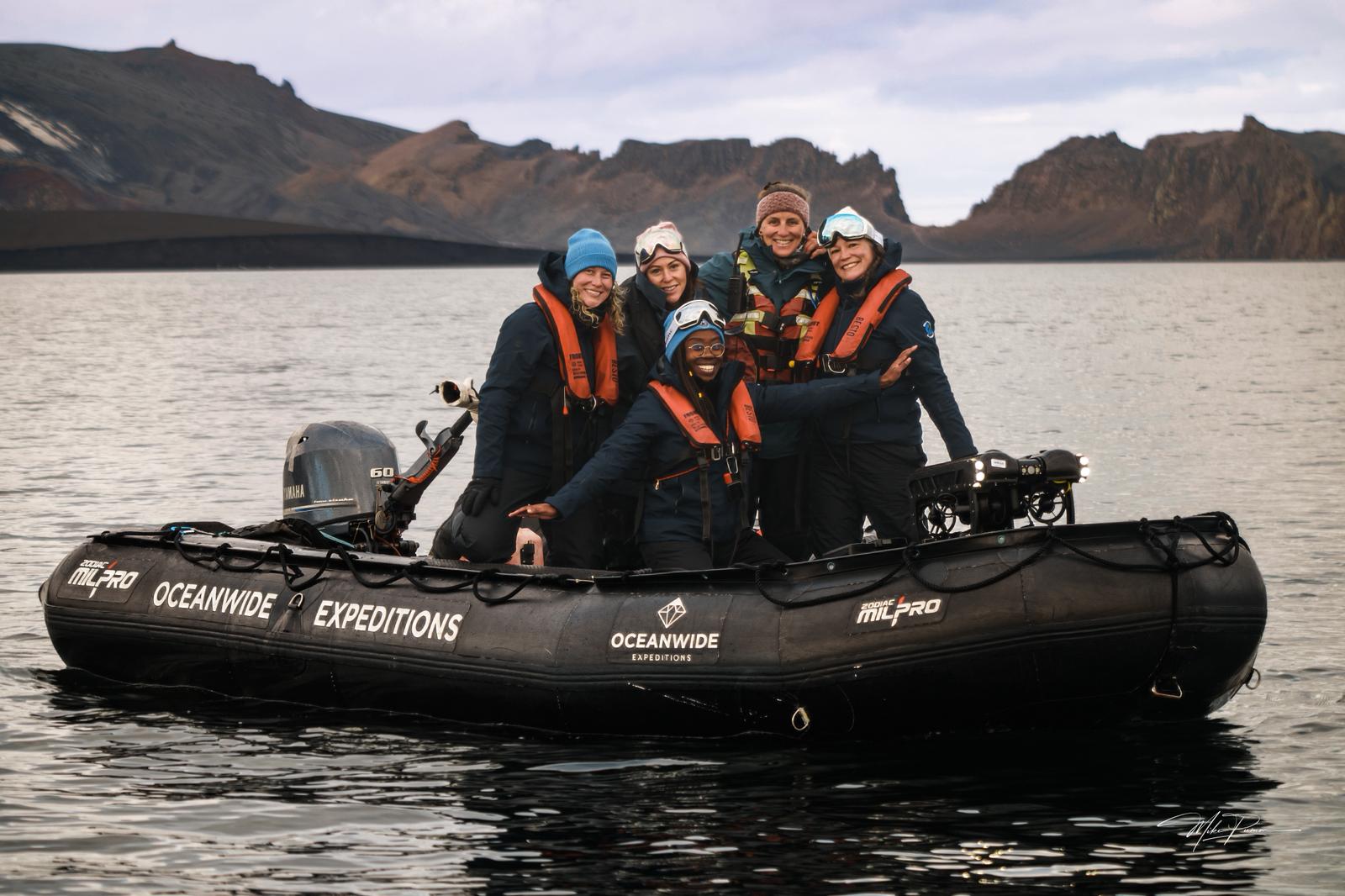
The expedition's dedicated ROV team included:
Harris summarized the team effort:
“This was a masterclass in teamwork, trust, leading with initiative in times of uncertainty, expedition logistics, and the power of professional contacts who believe in your dreams.”
The Deep Trekker PIVOT ROV was chosen for its portability, reliability, single-operator deployment, and operational demands of remote Antarctic fieldwork from a zodiac-based platform.
Designed for rapid deployment by a single operator, the compact system minimized mobilization requirements while delivering high-quality underwater imagery needed for scientific observation. Its removable battery system allowed the vehicle to travel as checked airline luggage, eliminating the cost, logistical complexity, and risk associated with shipping specialist robotic equipment to Antarctica.
Equally important was the support provided by the Deep Trekker team. Their professionalism, responsiveness, and solutions-focused approach ensured the expedition had access to a fully capable observation-class ROV within a demanding project timeline. The expedition's ROV team also benefited from the support of Erica Moulton of the Center for Open Exploration, whose commitment to expanding opportunities within the ROV community helped bring this collaboration together. Her advocacy for women in polar research and her connections across the observation-class ROV sector exemplify the collaborative spirit that drives innovation and scientific exploration.
In a highly specialized industry where collaboration and trusted professional networks are essential, partnerships like this enable scientific and industry teams to access the right technology when it matters most.

Visual surveys revealed exceptionally rich and abundant benthic communities, highlighting the remarkable biodiversity present within Antarctic coastal ecosystems. The ROV also contributed to marine mammal observations, including the world's first leopard seal ethogram study led by expedition team member Sarah Neill, by enabling remote underwater documentation of this apex predator and complementing in-water observations conducted by the expedition team. By extending observation capabilities and reducing the need for prolonged close-proximity monitoring, the ROV provided an additional tool for documenting natural behaviours while supporting responsible wildlife research in a sensitive polar environment.
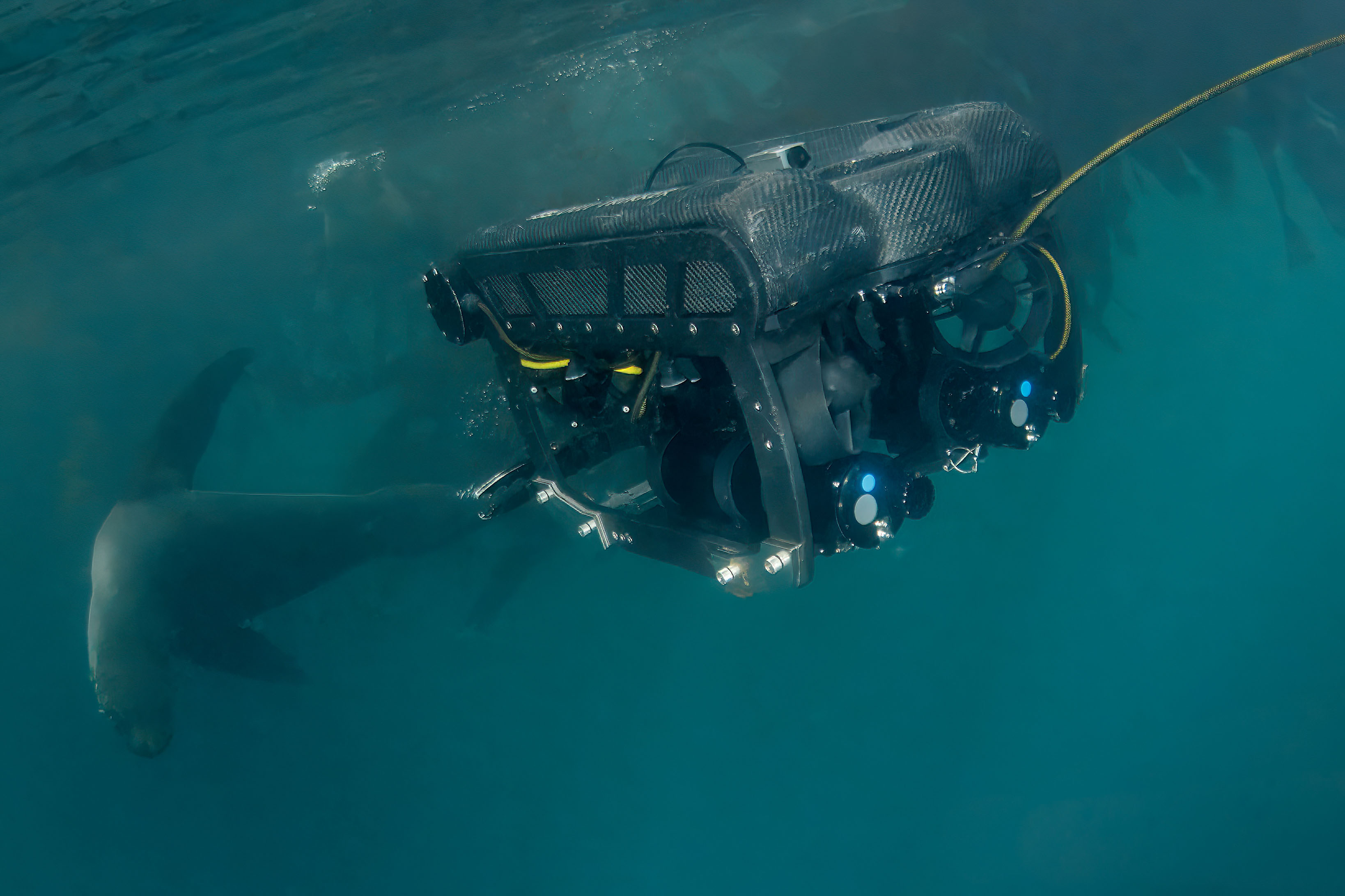
Hydrothermal reconnaissance at Deception Island produced significant findings, including video documentation of hydrothermal vent systems that is believed to represent the first recorded footage from the study area. These observations provide an important foundation for future research into the geological and biological processes associated with Antarctic hydrothermal systems.
The Deep Trekker PIVOT ROV system also contributed to the documentation of glacier-influenced coastal environments. By comparing contemporary observations with historic records and maps from the Shackleton-Rowett Expedition (1921–1922), the team gained valuable insight into the scale of glacial retreat over the past century. These observations provide important visual context for understanding long-term environmental change in Antarctica and demonstrate the value of combining historical expedition records with modern underwater technologies.
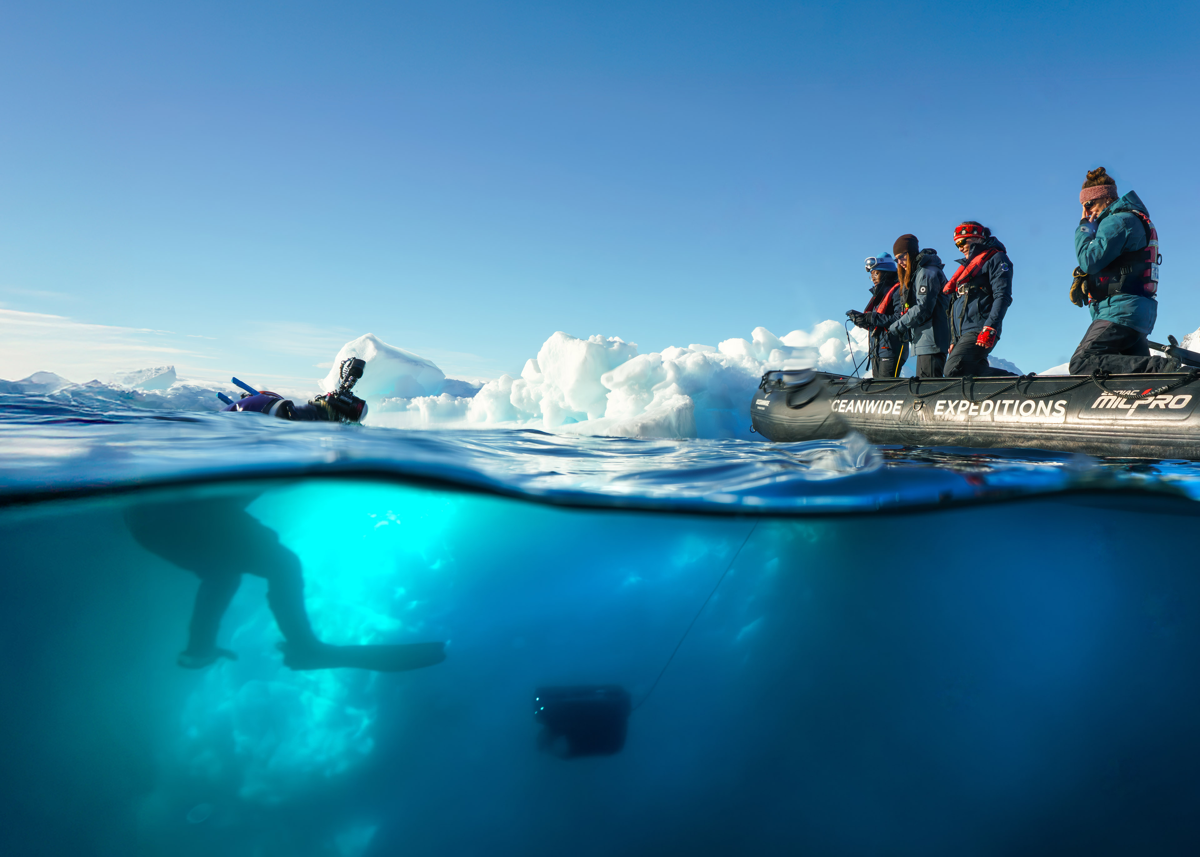
The investigation and positioning of historic whale bone deposits offered a unique opportunity to examine Antarctica's maritime heritage beneath the ice. These remnants, left behind by industrial whaling operations during the late nineteenth and early twentieth centuries, provide an important archaeological and environmental record of profound human impacts that once shaped the Southern Ocean. Documenting these sites helps place today's protected marine ecosystems into their historical context and highlights the importance of long-term conservation efforts.
Discover how Natural England uses ROVs to improve marine habitat monitoring, reduce costs, and improve marine protected area surveys across the UK coastline.
Collectively, the expedition’s Submersible Science Team demonstrated how a compact observation-class ROV can support interdisciplinary polar research, generating valuable scientific observations across marine ecology, geology, oceanography, glaciology, and maritime heritage within a single field campaign.
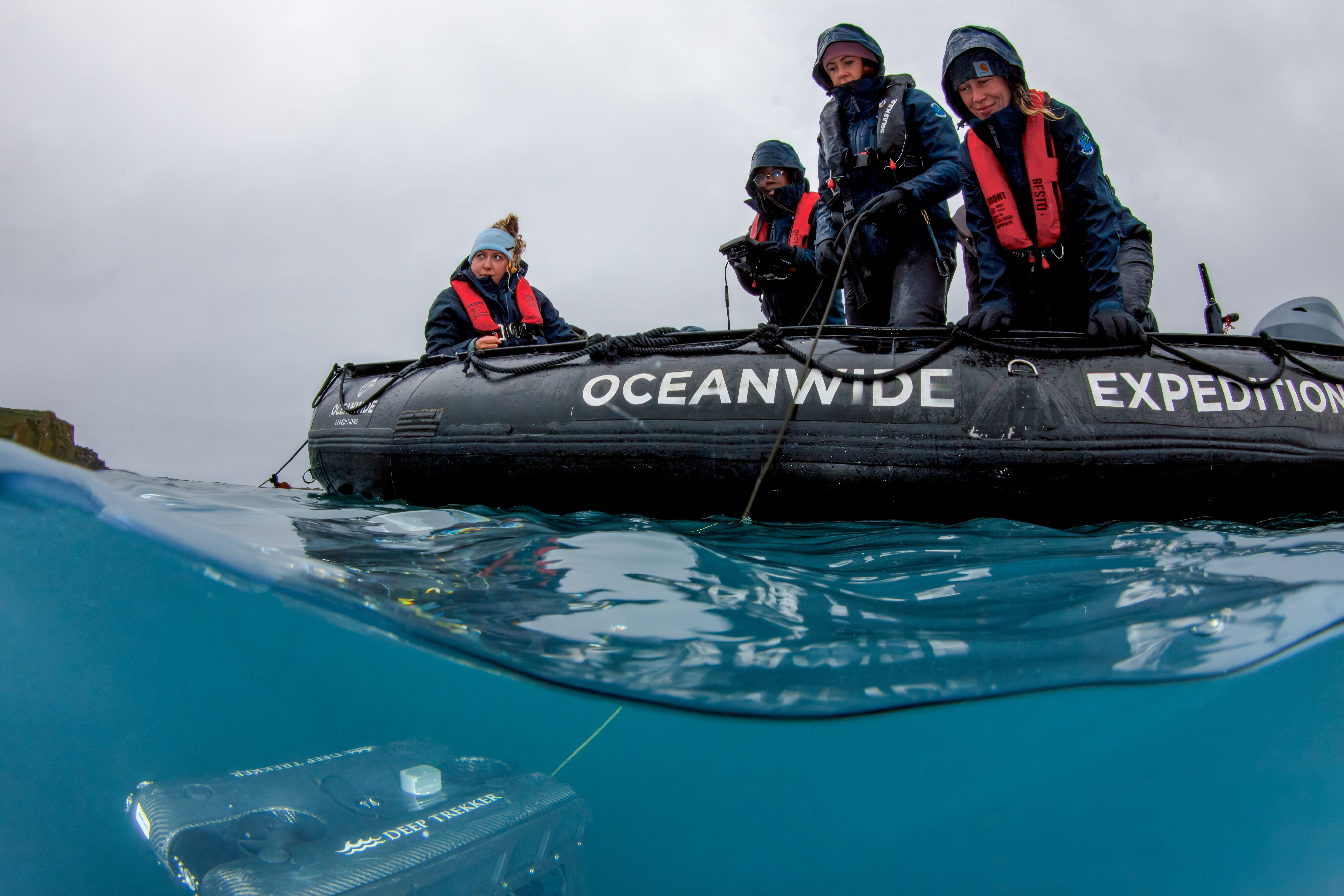
Key ROV operational advantages included:

The expedition model also extends beyond fieldwork, incorporating education and outreach programs. Since 2014, the organization has conducted multiple Arctic expeditions and engaged over 1,000 participants through training initiatives in ocean science and robotics.
Geographic Information Systems (GIS) played a central role throughout the expedition, providing the spatial framework that connected scientific observations, historical records, and field operations into a single georeferenced environment. GIS enabled the team to plan operations, interpret findings, and understand how individual datasets related to the broader Antarctic environment.
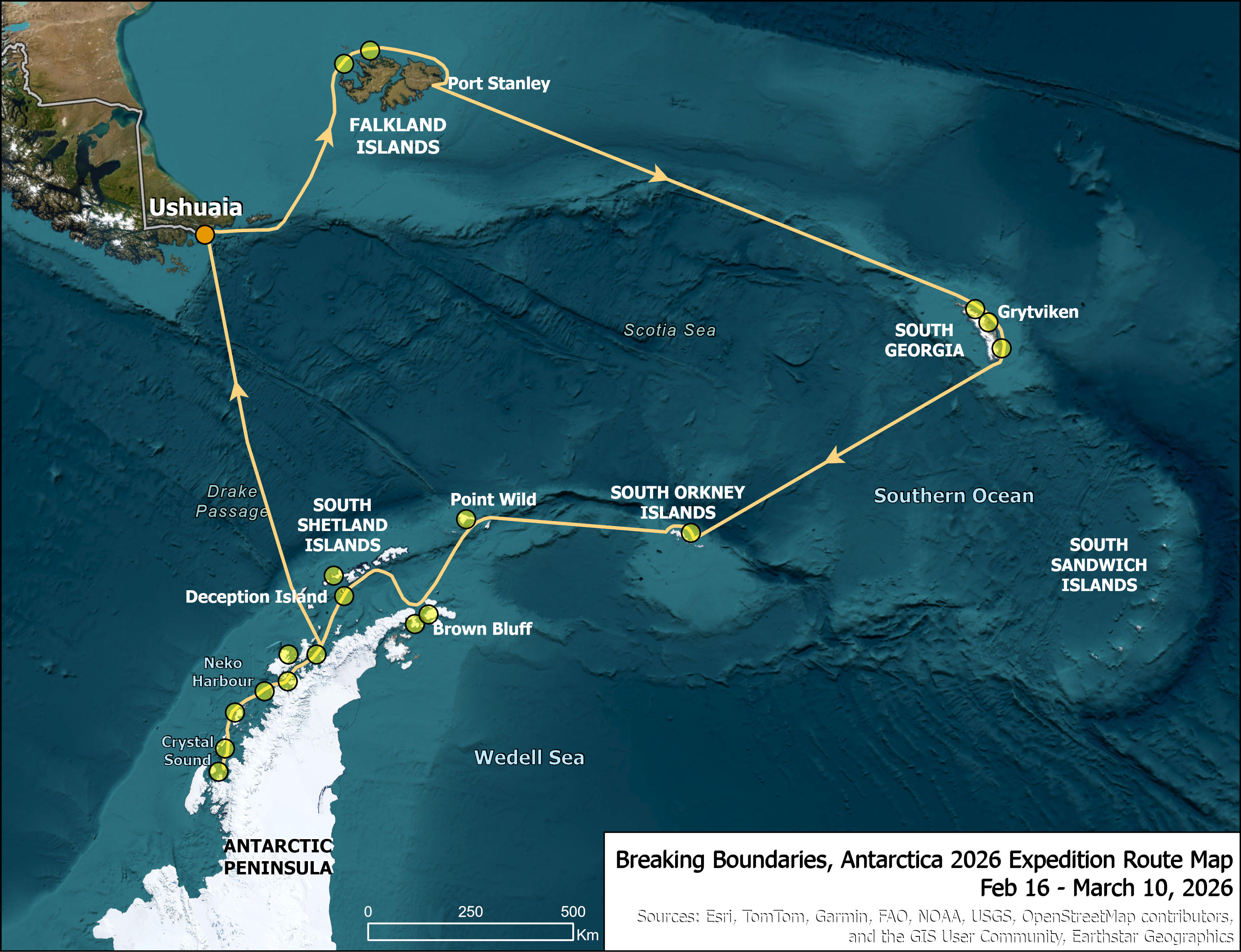
Through Esri Canada’s partnership with the team, ArcGIS Online and ArcGIS StoryMaps were used to develop interactive platforms that transformed complex scientific datasets into accessible visual narratives.
By combining maps, photographs, videos, historical context, and expedition observations, StoryMaps enabled both the expedition team and the public to explore the science geographically; strengthening communication, education, and engagement beyond the expedition itself - in a way that is both technically rigorous and accessible to wider audiences.
Alex Miller, president of Esri Canada, described the role of mapping systems:
“Maps are a universal language that transcend borders, cultures and backgrounds, making it possible for people everywhere to understand and engage with complex scientific discoveries visually.”
Explore how Marine Science benefits from ROV technology to improve environmental monitoring and enhance research efforts for more efficient and precise results.
Researchers documented glacier retreat, newly exposed seabed features, and new coastal lagoons in once ice-covered areas, with changes assessed against 1921–22 Shackleton-Rowett expedition maps.
Visible indicators of environmental change were documented across several glacier-influenced environments, including glacier retreat, newly exposed seabed features, and the formation of coastal water bodies in areas that were historically ice-covered. These observations were considered within the broader context of a warming Southern Ocean and the increasing sensitivity of polar coastal ecosystems to changes in ice cover, ocean temperature, and glacial dynamics.
Geological sketch maps from the 1921–22 Shackleton-Rowett Quest Expedition overlapped with several of the regions that were investigated during this expedition. Maps prepared by geologist George Vibert Douglas highlighted geological and glacial features that marked glacial landforms and the maximum extent of ice as a baseline of what changes have occurred over the past 100 years.
Observed indicators included:
By integrating field observations, historical records, GIS workflows, and ROV imagery, the expedition's Submersible Science Team helped document these changes in a way that supports future monitoring, comparison, and scientific interpretation.
The submersible science program on this expedition highlighted the value of combining scientific expertise with practical, field-ready technology. By supporting the team with an observation-class ROV, Deep Trekker's PIVOT ROV enabled scientific observations that may otherwise have been difficult to obtain. As polar research continues to evolve, partnerships between researchers, technology providers, and the wider marine robotics community will play an increasingly important role in advancing our understanding of the ocean while making exploration more accessible, efficient, and safe.

Connect With Us to Support Your Next Field Mission
July 3rd, 2026
Everything you need to become an ROV pilot: what the job...
September 1st, 2026
Compare imaging, side scan, echosounder, and 3D sonar systems for underwater...
December 23rd, 2021
ROVs and sonar can be used to inspect underwater structures such...