Configure Now
Items in Your Cart0
0Items in Your Cart
Start building your packageShop Now
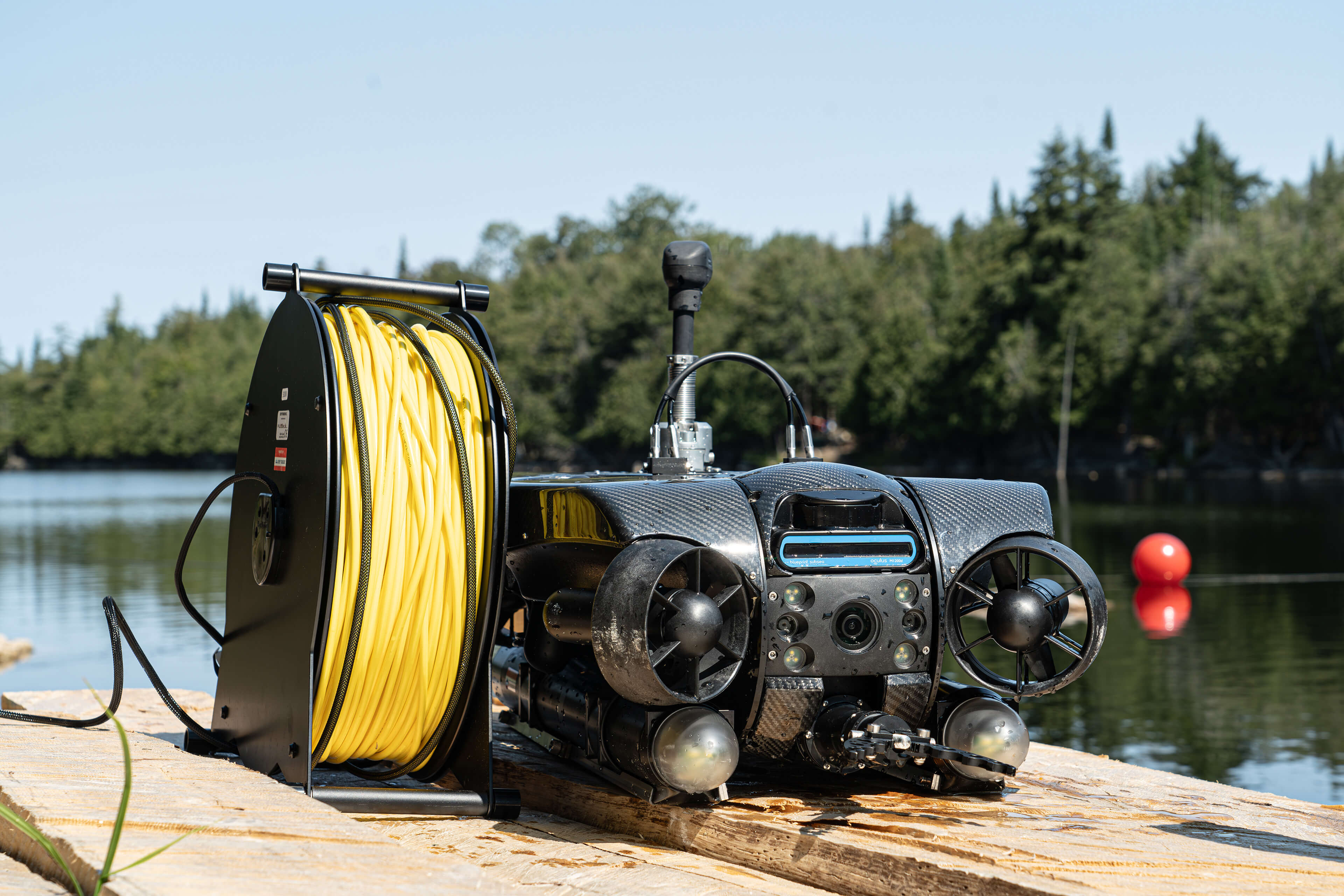
We’re excited to announce our latest innovation in underwater positioning technology: ROV GPS. This advanced system provides accurate surface-based navigation for remotely operated vehicles (ROVs), ensuring reliable positional tracking in real-time.

ROV GPS delivers continuous real-time recalibration, allowing operators to track their ROVs precisely when surfaced. Integrating seamlessly with Deep Trekker’s REVOLUTION and PIVOT models, the GPS module automatically recalibrates, offering stable position updates during mission execution. Its ability to work in tandem with Deep Trekker’s dead reckoning implementation improves tracking precision further.

To achieve the highest accuracy, ROV GPS supports Real-Time Kinematic (RTK) and Satellite-Based Augmentation System (SBAS) corrections. RTK integration enables positioning accuracy of up to 2.5 centimeters, significantly improving the precision of underwater surveys and inspections. The system supports major satellite constellations, including GPS, GLONASS, BeiDou, and Galileo.
While traditional GPS is ineffective underwater, Deep Trekker’s ROV GPS system utilizes surface positioning to keep the ROV on track. By integrating with the Mission Planner feature, operators can track the ROVs surface position and correlate it with known coordinates, ensuring accurate navigation during underwater surveys, inspections, and asset maintenance.
With the ability to log GPS waypoints and record the complete history of ROV movements, operators can analyze this data post-mission. These logs provide valuable insights into navigation patterns and correlations between surface positions and underwater paths, improving overall mission efficiency, accuracy, and success.

One of the key benefits of Deep Trekker’s ROV GPS is its ability to deliver precise surface-based navigation without relying on a USBL (Ultra-Short Baseline) system. This feature is particularly valuable in challenging environments, where USBL systems may be impractical or cost-prohibitive.
ROV GPS is designed for operators who need consistent positional accuracy over extended periods, particularly in environments where USBL or other navigation systems may not be feasible. It is ideal for:
Deep Trekker’s ROV GPS brings an unprecedented level of precision and ease of use to underwater operations. By offering surface tracking with millimeter-level accuracy, it ensures operators can maintain consistent navigation even in environments with magnetic disturbances or noisy water. The system also serves as a reliable reference for onboard Inertial Navigation System (INS) devices, providing correction and recalibration throughout the mission. The GPS system acts as a single point of truth, correcting errors and ensuring accurate surface positioning without the need for costly USBL systems.
Designed as a fully integrated, plug-and-play solution, the ROV GPS eliminates complex setup procedures, allowing users to focus on the mission rather than technical configurations. With its quick mounting system and compatibility with major satellite constellations, it is ready to operate immediately in challenging conditions.
Whether performing asset maintenance, underwater inspections, or complex surveys, the ROV GPS allows operators to achieve precise, real-time navigation and post-mission analysis. Its robust construction and user-friendly design make it ideal for harsh marine environments, where reliability and precision are critical.
By integrating the ROV GPS with Deep Trekker’s advanced ROV platforms, operators are equipped with the tools to meet the most demanding underwater challenges with confidence and control.
Our experienced team is at your service to offer expert guidance for a range of applications and industries. We ensure tailor-made solutions that precisely match your specific requirements. When you're prepared to acquire your Deep Trekker ROV, don't hesitate to get in touch with us for a personalized quote.

March 17th, 2026
Two-day AIMS training program teaches SAR teams how to integrate sonar...
March 11th, 2026
Deep Trekker’s SPECTRA ROV integrates 3D Sonar SLAM, 4K stereo vision,...

November 3rd, 2025
At REPMUS 2025, Deep Trekker’s ROVs validated real-world mine countermeasure capabilities...